
3D Laser Scanning & Modeling Services
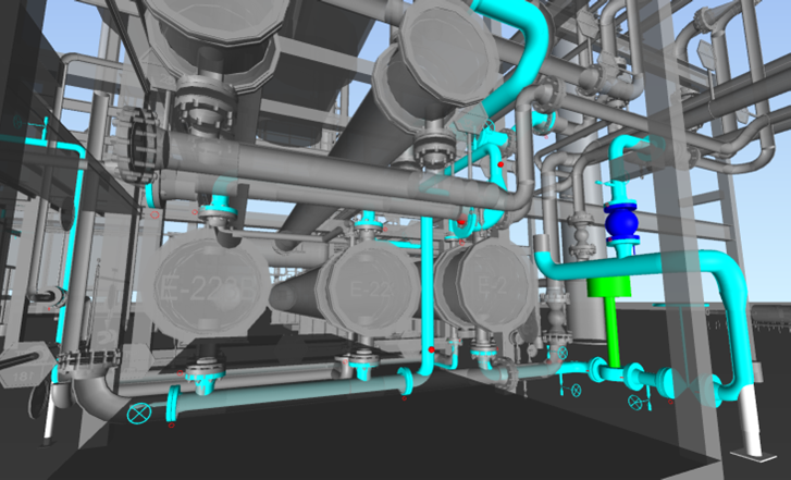
KRC provides nationwide 3D laser scanning and modeling services to capture accurate existing conditions for engineering, construction, facility upgrades, and retrofit projects.
Deliverables can include AutoCAD 2D files, AutoCAD Plant 3D models, Navisworks files, point cloud data, and Matterport walkthroughs.
Laser Scanning and 3D Modeling Capabilities
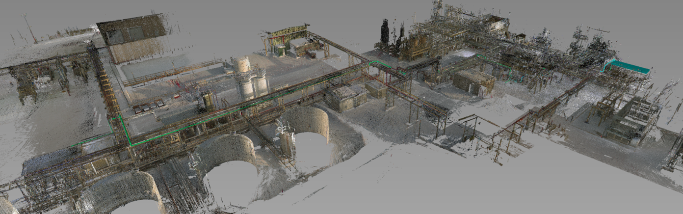
KRC uses reality capture technology to document existing facilities, equipment, and infrastructure with detailed spatial data.
High-Resolution Laser Scanning
KRC uses the Leica BLK2GO handheld imaging laser scanner to capture detailed spatial data while moving through a facility or project site. This approach allows complex spaces, equipment, piping, and infrastructure to be efficiently documented.
3D Model Development
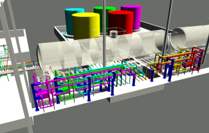
Captured scan data is processed into a consolidated file that KRC can use with AutoCAD Plant 3D to create multi-discipline models reflecting real-world dimensions and spatial relationships.
Georeferenced Models
Models can be aligned with onsite coordinates, giving engineering and design teams a consistent spatial reference for project planning and coordination.
Digital Facility Documentation
AutoCAD Plant 3D allows scan-based models to incorporate facility data that can support digital twin applications, future upgrades, maintenance, and long-term facility planning.
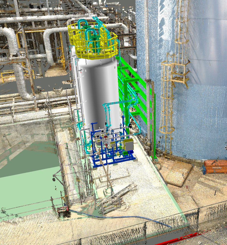
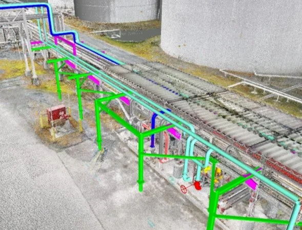
3D Laser Scanning for Existing Facilities and Infrastructure
Laser scanning is particularly valuable for projects where current drawings are limited, conditions have changed over time, or complex existing infrastructure needs to be incorporated into new work.
KRC's services can support:
Retrofit and renovation projects
Refinery turnarounds
Facility upgrades and expansions
Construction and design validation
Asset management and maintenance planning
As-built and existing-condition documentation
KRC can also provide Matterport scanning through a local partnership to give project teams additional visual context for remote review and coordination.
Improve Design and Construction Coordination
Reliable field data gives project teams a clearer understanding of a facility before design or construction begins. By capturing complex conditions digitally, laser scanning can reduce manual field measurements and repeat site visits while helping teams identify potential conflicts earlier in the project.
The resulting data also provides a valuable reference throughout design, construction, and future facility modifications.

3D Laser Scanning Project Highlight
North Pole Refinery
Overview
KRC provided 3D laser scanning and modeling services at the North Pole Refinery to capture existing facility conditions and support multi-discipline engineering and design. The resulting scan data provided an accurate digital representation of existing infrastructure, helping the project team coordinate new design work with real-world site conditions.
KRC’s capabilities statement specifically identifies North Pole Refinery work and describes its process of using detailed point clouds to create georeferenced, multi-discipline 3D models for project review, design coordination, and construction planning.
Scope of Work
Captured existing facility conditions using 3D laser scanning
Developed detailed point cloud data for engineering and design
Created coordinated 3D models of existing infrastructure
Supported integration of new designs with existing facility conditions
Provided multi-discipline engineering and design support
Supported development of Issued for Construction (IFC) contract documents
Project Deliverables
KRC provided full IFC contract documents, including:
Mechanical drawings
Civil drawings
Structural drawings
Instrumentation drawings
Electrical drawings
Project specifications
3D Laser Scanning FAQs
-
3D laser scanning is used to digitally document facilities, structures, equipment, piping, and infrastructure. The captured information can support engineering design, retrofits, upgrades, construction planning, and as-built documentation.
-
Depending on project requirements, KRC can provide AutoCAD 2D files, AutoCAD Plant 3D models, Navisworks files, point cloud data, and Matterport walkthroughs.
-
KRC uses the Leica BLK2GO handheld imaging laser scanner, which captures 3D spatial data as the operator moves through a space. Matterport scanning is also available through a local partnership.
-
Accuracy can vary based on the scanning equipment, field conditions, environment, and specific project requirements. KRC works with clients to determine the appropriate scanning and modeling approach for each project.
-
Yes. It is particularly useful when renovations, retrofits, or new designs need to account for existing piping, equipment, structures, and other infrastructure.
-
Yes. KRC's scan data can be processed and used within AutoCAD Plant 3D to develop accurate facility models and incorporate data that supports digital twin applications.
Want more technical information?
Download KRC’s Laser Scanning & 3D Modeling Capabilities Statement (PDF)
Start Your 3D Laser Scanning Project
Have a laser scanning or 3D modeling project in mind? Call KRC at (907) 921-8647, email KRCadmin@kcorpalaska.com, or complete the form to discuss your facility, project requirements, and schedule.